Red Warrior – Warfield Creek Loop
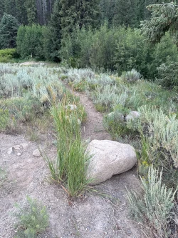
Some days you just want to put some miles on your boots and this hike gets the job done with style. Red Warrior begins with a pleasant stroll up an easy grade under the shade of pine forest. As you continue, the forest begins to show signs of the devastating 2007 Castle Rock Fire, though its remarkable recovery grows more evident each season. The climb intensifies at about 2.5 miles and the trail opens to incredible views of the Smoky Mountains. By the time you near the saddle that takes you over to Warfield Creek, you will likely have this beautiful, rugged part of the world to yourself. The winding descent traverses groves of young pines growing amid their charred elders, providing an excellent opportunity to observe the process of forest regeneration following wildfire. You will also very likely see wildlife, including deer, elk and dusky grouse.
As an added bonus, the Frenchman’s Bend Hot Springs are a few hundred feet from the parking lot for the hike, so when the river level is right, it’s easy to soak your tired legs after the long journey.
One final note: Completing the loop requires a half mile walk along Warm Springs Road, so you may wish to leash your dog during that portion of the hike.


1950 feet total elevation gain
 Hardest Mile: 8%
There are bathroom facilities at the trailhead.

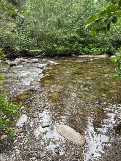
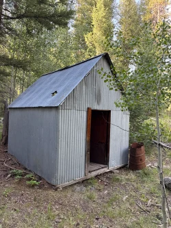
The trail bends to the left and a creek runs alongside, crossing the path three times over the first mile and a half. Pines offer plenty of shade over this section. At about 1.6 miles, come to an old metal shack that can serve as a camping spot.
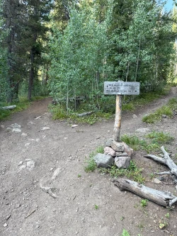
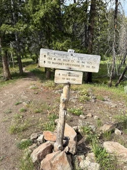
After passing the shack, evidence of the 2007 Castle Rock Fire grows clearer and the charred trees offer less protection from the sun. Over the next half mile or so, you will cross the stream eight times. At 2.45 miles come to a signed intersection with Red Warrior-Lodgepole. Turn right to continue on Red Warrior.
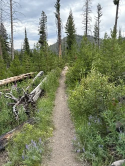
The climb intensifies after another easy water crossing at the 2.5 miles mark. With each step through the charred forest, the view expands, providing stunning vistas of the Smoky Mountains. Come to a pair of water crossings at about 3.2 and 3.35 miles. The second crossing is the last easily accessible water until the 8.75-mile mark, so refill water bottles as necessary.
The climb continues, mainly in open sun, though small patches of pine offer a little relief starting at about 4.7 miles. Finally, come to a signed junction at about 5.3 miles. Stay straight to continue onto the Red Warrior-Warfield Connector. This is also a great spot to sit, grab a protein bar and enjoy the magnificent views.


The remote Red Warrior-Warfield Creek Connector trail rolls up and over a saddle mainly through mountain meadows that are awash in wildflowers in mid-summer. There are a few sections of climb, but it is a pleasant walk with amazing views of the Smoky Mountains. This is a section to catch your breath and enjoy being alone in Idaho’s beautiful wilderness. Eventually the trail descends and at 6.6 miles, come to a junction with Warfield-South Fork Warm Springs. Turn right to continue the descent.


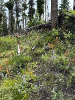
The descent continues along a mid-ridge rocky trail which curves in and out of spruce forest via several switchbacks. This section highlights the forest’s remarkable recovery as patches of small pine line a few sections of the trail and wildflowers grow in the shadow of fallen, burnt trees.
At about 8.5 miles, come to a mud puddle and then cross Warfield Creek twice. The wider crossing at about 8.75 miles is a good spot to refill water bottles.
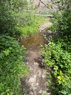
After the crossing, the trail undulates through the woods with the creek running to your right and a tallus-covered hill to your left. Over the next couple miles, tallus impedes onto the trail regularly, making footing difficult. The trail crosses the creek several times, but by mid-summer it has usually run dry. This is the least interesting part of the hike, though the last half mile does improve with the cover of trees, mimicking the start of the Red Warrior Trail.
At about 11.4 miles, come back to the Big Wood River. Again, it will be impossible not to get wet except in very low water years.

Warm Springs Road lies just on the other side of the river. Take a right and walk about a half mile back to the parking lot.
Hike Categories
Distance: 8+
Difficulty: Hard
Drive: Moderate
Scenery: Nice
Shade: Moderate
Solitude: Quiet
Experience: Beyond the Ordinary
Locations: Smokys