The West Fork of the North Fork of the Big Wood River
This hike needs better marketing. If it were named “Hidden Valley” or “Pristine Pass,” it would be a staple hike for locals and tourists alike. Although it is as breathtaking and demanding as popular routes such as Pioneer Cabin and Johnstone Creek, those who discover this trail often enjoy the tranquil, stunning valley in solitude. It is a hidden gem that offers the best of the Boulder Mountains: wild beauty, diverse terrain, and demanding yet rewarding ascents.
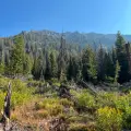
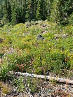
The hike begins with a gentle ascent under the shade of forest before entering a large sagebrush meadow that is awash in midsummer wildflowers. The last section before the turnaround is an arduous climb along a forested ridge that mercifully levels out on a peaceful mountaintop meadow.


2025 total elevation gain
 Hardest Mile: 13.1%
From downtown Ketchum, the trailhead can be reached by traveling 8 miles on paved roads followed by 4.5 miles on a dirt road featuring small boulders and some uneven terrain. Lower clearance vehicles should exercise caution.
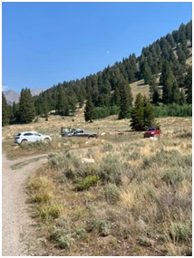
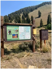
Click here for directions to the trailhead. There is parking for about eight vehicles. Other hiking options from the trailhead are the more frequently used Amber Gulch and Amber Lakes as well as West Pass and North Fork of the Big Wood River.
There are no bathroom facilities at the trailhead.

The trail rolls and at .6 miles you will ford the North Fork of the Big Wood River. During periods of high water you will be forced to cross over a large log which lies six feet above the river bottom. During low water there are other options, but none are particularly easy so consider wearing waterproof shoes for this hike.

The trail ascends gradually through the trees and at about 1.5 miles, you will cozy up to a pool that is an excellent place for dogs to cool down and get a drink. It is not easily accessible for humans, but right before the dog pool there is a section of river where you can fill your water bottles. Given what is coming next, it is wise to use a filter and top off your bottles.

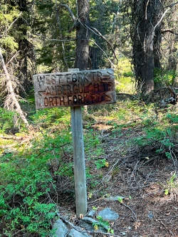
At 1.7 miles, you will come to a signed junction with Amber Gulch/Lakes. Turn right.
The trail winds and rolls through the forest until at about 2.3 miles you reach the sagebrush field. There is no tree cover here, so it will get hot in mid-day and there is little to no access to water – during wetter periods, a small creek passes through the field towards the end of the section, but it often runs dry.
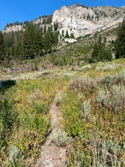
As you pass through the fields, take some time to take in the 360-degree views of the wild Boulder Mountains that surround you. This is what hiking Idaho is all about.
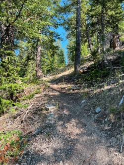
Right before the 3-mile mark, you re-enter the forest and begin an arduous mile-long climb to the destination. Thankfully, most of the 700-foot elevation gain is in the shade of trees, though there are some short sections in direct sun. A narrow waterfall marks the beginning of the ascent and as you continue, a few hidden waterfalls crash in the distance.
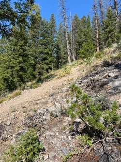
After a little less than a mile of climbing, the trail opens and levels out on a mountaintop meadow. In mid-summer you will find a variety of wildflowers mixed among the small Douglas Firs.
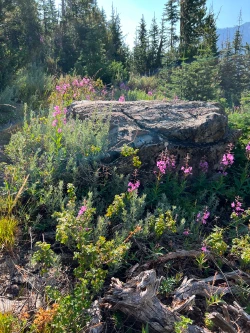
The trail peters out at about the 4-mile mark as you pass through some firs, but if you continue through the fields beyond the trees, you will see an outcropping of rock to your right. Scramble up the rocks to the final destination, which affords tremendous 360-degree views.
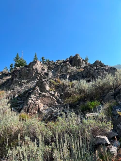
The valley floor below the rock outcropping is an excellent spot to pitch a tent and spend the night. Those seeking even more of a challenge can continue to hike up the canyon about a half mile with 500 feet of elevation gain to reach the base of another waterfall.
Hike Categories
Distance: 8+
Difficulty: Hard
Drive: Moderate
Scenery: Spectacular
Shade: Shady
Solitude: Quiet
Experience: Beyond the Ordinary
Locations: Boulders